| |
|
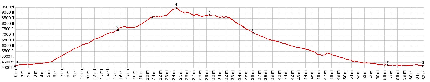
1.(mile00.0,4220ft)START-END WEST-1: Shell
2.(mile15.6,7460ft)profile turns right onto FR17
3.(mile20.8,8630ft)Snowshoe Pass(shp)
4.(mile24.5,9450ft)TOP
5.(mile29.5,8790ft)profile turns left onto Alkali Rd
6.(mile36.1,7170ft)profile turns left onto Red Gulch Rd
7.(mile56.4,4240ft)jct US14 - Red Gulch Rd, west of Shell
8.(mile61.9,4240ft)START-END WEST-2: Shell, same as point 1
|