| |
|
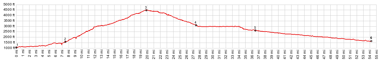
1.(1050ft,mile00.0)START-END: Packwood
2.(1610ft,mile07.5)turnoff on left goes to Cayuse Pass in Mt Rainier National Park
3.(4501ft,mile19.9)TOP: White Pass
4.(3130ft,mile27.3)western jct with Tieton Reservoir Rd on left
5.(2630ft,mile36.4)START-END WEST: eastern jct with Tieton Reservoir Rd
6.(1600ft,mile54.1)START-END EAST: jct US12-Wa410 on Naches River
|
|
-