| |
|
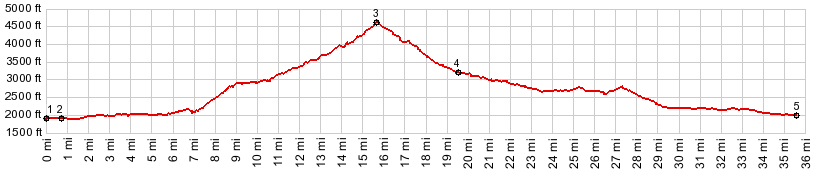
1.(1900ft,mile00.0)START-END
NORTH: west end of Lake Wenatchee on Wa207
2.(1960ft,00.8m)profile goes left on Little Wenatchee
River Rd
3.(4600ft,mile15.7)TOP: Rainy Pass
4.(3230ft,mile19.5)profile turns left onto US2
5.(1990ft,mile35.4)START-END SOUTH: jct US2 - Wa207
|
|
-