| |
|
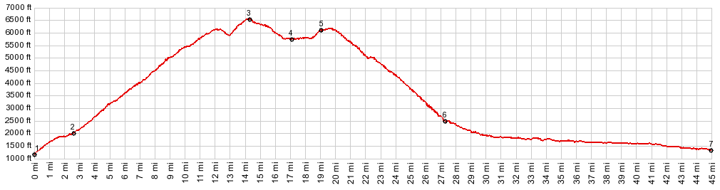
1.(1160ft,mile00.0)START-END NORTH: jct S Lakeshore Rd - Shady Pass Rd, just west of Twenty Five Mile Creek State Park on Lake Chelan
2.(2000ft,mile02.6)profile stays right at jct with Slide Ridge Rd
3.(6540ft,mile14.5)TOP: turnoff to Junior Point is on left
4.(5730ft,mile17.1)intermediate low point
5.(6100ft,mile19.0)Shady Pass: turnoff to Big Hill on right
6.(2470ft,mile27.3)profile turns left onto Entlat River Rd
7.(1320ft,mile44.9)START-END WEST: jct Wa19 Entlat River Rd - Wa287 Mud Creek Rd
|
|
-