| |
|
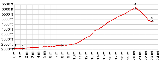
1.(00.0m,2110ft)START-END EAST:jct Goat Creek Rd crosses Goat Creek, east of Mazama
2.(01.4m,2110ft)Mazama and start of Lost River Rd
3.(07.9m,2410ft)western entrance to Mazama airstrip, and near end of pavement
4.(20.2m,6180ft)TOP: Hart's Pass
5.(23.1m,4800ft)START-END WEST: low point on FS700 with jct to FS374
|
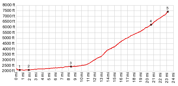
1.(00.0m,2110ft)START EAST:jct Goat Creek Rd crosses Goat Creek, east of Mazama
2.(01.4m,2110ft)Mazama and start of Lost River Rd
3.(07.9m,2410ft)western entrance to Mazama airstrip, and near end of pavement
4.(20.2m,6180ft)Hart's Pass
5.(23.1m,7440ft)TOP: Slate Peak
|