|
|
|
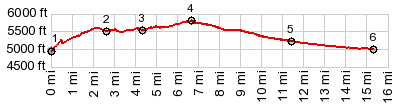
1.START-END EAST: Ut45 crosses White River
2.profile turns left on Chipeta Wells Rd
3.profile turns left onto unsigned track
4.TOP, 5800ft
5.profile rejoins wide gravel road
6.START-END WEST: intermediate low point on Chipeta
Wells Rd
|