| |
|
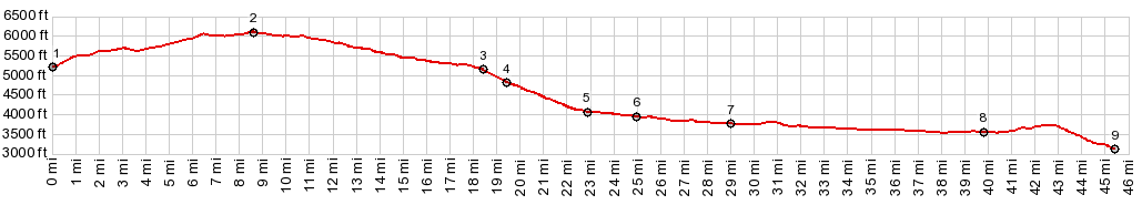
1.(00.0k,5200ft) START-END WEST: Mt Carmel Junction
2.(08.6m,6090ft)TOP
3.(18.2m,5150ft)tunnel entrance west side
4.(19.4m,4810ft)tunnel exit east side
5.(22.9m,4870ft)jct with Zion Canyon Scenic Drive
6.(25.1m,3940ft)Springdale
7.(29.0m,3770ft)Rockville: jct with Smithsonian Black Canyon Scenic Byway
8.(39.8m,3560ft)jct with Mesa Rd to Hurricane Mesa
9.(45.4m,3130ft) START-END EAST: low point just north of La Verkin
|