| |
|
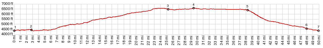
1.(00.0mile,4350ft) START-END EAST:low point on US163, just east of jct with CR235 Comb Wash Rd
2.(02.8mile,4420ft)stay left on CR237 Snowflats Rd
3.(25.3mile,6470ft)profile turns left onto Ut261
4.(29.6mile,6640ft)TOP: highest point for this route
5.(38.4mile,6380ft)Moki Dugway Overlook
6.(48.0mile,4560ft)profile turns left on US163
7.(50.0mile,4350ft)low point on US163, direction Bluff
|