| |
|
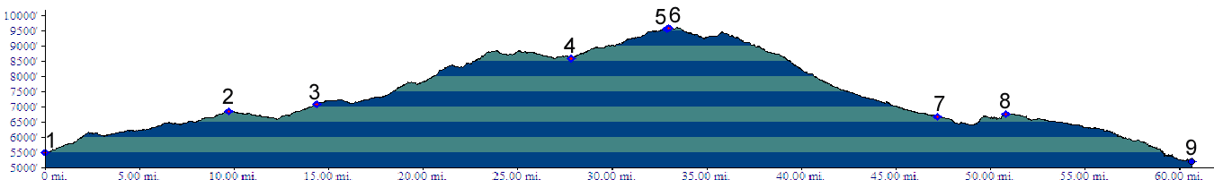
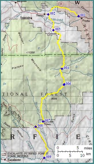
1.(5490ft,mile00) START-END NORTH: Ut24 turnoff to Capitol Reef NM visitor center
2.(6840ft,mile10) profile turns left onto Ut12 to Escalante
3.(7100ft,mile15) paved right goes to Teasdale; profile continues straight
4.(8600ft,mile28) alternate unpaved approach from South Draw road joins from left.
5.(9570ft,mile33) double track trail to Boulder Mountain leaves on right
6.(9591ft,mile33) TOP
7.(6700ft,mile47) START-END ALTERNATE: town of Boulder and junction with Burr Trail
8.(6770ft,mile51) dirt road on right goes to Hell's Backbone Bridge
9.(5220ft,mile61) START-END SOUTH: Ut12 crosses Escalante River