| |
|
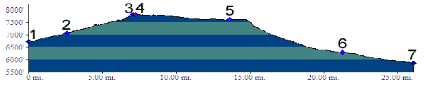
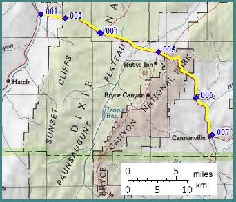
1.(6720ft,mile00) START-END WEST: junction US89 - Ut12
2.(7060ft,mile03) START-END WEST ALTERNATE Red Canyon bicycle trailhead
3.(7774ft,mile08) summit sign
4.(7825ft,mile08) TOP: junction with paved road on left to Antimony
5.(7610ft,mile14) junction with road on right to Bryce National Park
6.(6300ft,mile22) START-END WEST ALTERNATE: Tropic
7.(5870ft,mile26) START-END WEST: Cannonville