| |
|
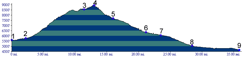
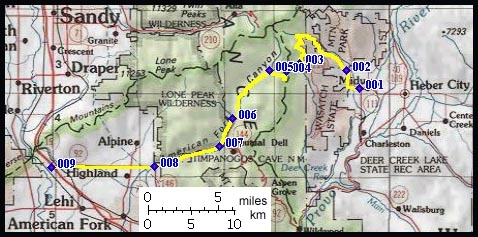
01.(5600ft,mile00) START-END EAST: downtown Midway
02.(5770ft,mile02) Wasatch State Park visitor center, route stays left
03.(8550ft,mile12) approach from Dear Creek joins from left
04.(8930ft,mile14) TOP: Pole Line Pass
05.(7680ft,mile16) route joins upper American Fork Canyon
06.(6370ft,mile22) Tibble Fork Reservoir, route is paved from downvalley
07.(6060ft,mile24) START-END WEST ALTERNATE: road joins Alpine Loop road on left
08.(5070ft,mile29) junction Ut146, Ut92 in Highland
09.(4640ft,mile36) START-END WEST: junction I15, Ut92