| |
|
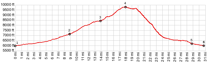
1.START-END SOUTH-1:jct 1200E - Ut153,
east of Beaver
2.jct with Kent's Lake Rd on right
3.profile turns left onto PST005
4.TOP, 9800ft
5.profile turns left onto paved road
6.START-END SOUTH-2:same as point 1
|