| |
|
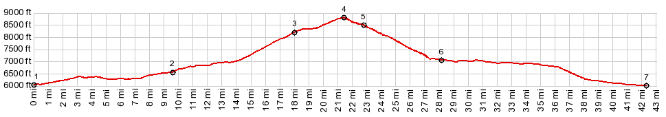
1.(00.0mile,6040ft) START-END EAST-1:
south of Monticello: jct US191-Ut211 to Canyonlands
Needles area
2.(09.7mile,6580ft)profile turns left onto Hart's Draw
Rd
3.(18.1mile,8230ft)jct with Shay Mtn Rd on right
4.(21.5mile,8850ft)TOP
5.(22.9mile,8480ft)road from North Creek Pass joins on
right
6.(28.1mile,7260ft)Monticello
7.(42.2mile,6210ft) START-END EAST-2: same as point 1
|