| |
|
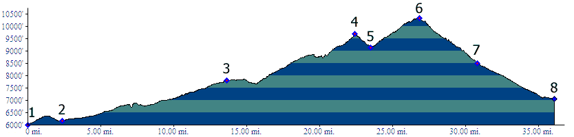
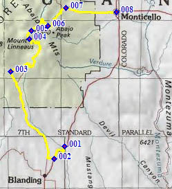
1.(6000ft,mile00) START-END SOUTH: Recapture Dam on US191, north of Blanding
2.(6170ft,mile03) profile turns right onto Pinyon Ridge Road, and right onto Blue Mountain Road, shortly after that
3.(7810ft,mile14) left goes to Causeway. Profile stays right
4.(9690ft,mile23) intermediate summit on Jackson Ridge
5.(9140ft,mile24) intermediate low point
6.(10312ft,mile28) TOP: North Creek Pass
7.(8500ft,mile31) profile turns right onto paved Ut49 to Monticello
8.(7060ft,mile36) START-END NORTH: Monticello, jct Ut49 - US191