| |
|
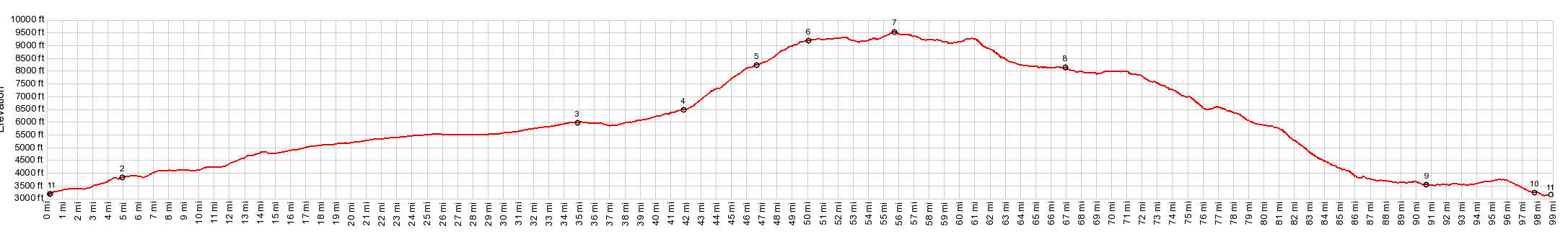
01.(00.0mile,3330ft) START-END WEST-1 :low point north of Toquerville
02.(04.9mile,3760ft)route goes onto I15 in Anderson Jct
03.(34.8mile,5930ft)profile leaves I15 at first Cedar City exit
04.(42.0mile,6490ft)route turns right up Right Hand Canyon Rd
05.(46.8mile,8220ft)jct with alternate unpaved approach through Cedar City hights development
06.(50.1mile,9150ft)approximate end of pavement
07.(55.7mile,9530ft)TOP
08.(67.1mile,8129ft)south side of Kolob reservoir, start of pavement
09.(90.8mile,3570ft)route turns right onto Ut9
10.(98.0mile,3250ft)La Verquin
11.(98.9mile,3330ft) START-END WEST-2: same as point 1
|