| |
|
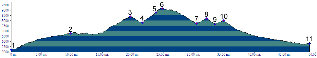
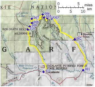
01.(5210ft,mile00) START-END EAST: Ut12 crossing Escalante River between town of Escalante and Boulder
02.(6770ft,mile10) profile turns left onto dirt road
03.(8390ft,mile20) first high point
04.(7820ft,mile22) low point
05.(8750ft,mile24) Hell's Backbone Bridge
06.(9160ft,mile25) TOP: point of highest altitude
07.(7730ft,mile31) low point
08.(8190ft,mile33) high point
09.(7650ft,mile34) low point
10.(8010ft,mile35) another high point and junction with Posey Lake Road on right
11.(5800ft,mile49) START-END WEST: Escalante