| |
|
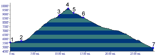
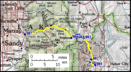
01.(5600ft,mile00) START-END WEST: downtown Midway
02.(5770ft,mile02) Wasatch State Park Visitor center, route continues right
03.(8880ft,mile10) approach from Park City joins from right at this major intersection. Route climbs ridge ahead.
04.(9710ft,mile12) TOP: Guardsman Pass
05.(9170ft,mile13) Great Western Trail trailhead to Scott's Pass
06.(8620ft,mile15) Big Cottonwood Canyon joins route from right
07.(4920ft,mile29) START-END EAST: junction Wasatch Boulevard, Big Cottonwood Canyon