| |
|
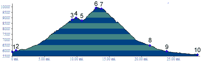
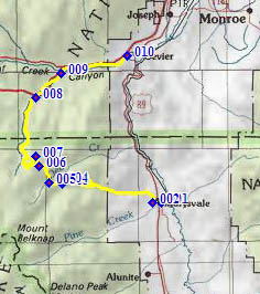
01.(5880ft,mile00) START-END SOUTH: Marysvale
02.(6010ft,mile01) jct with several other forest access roads, west of Marysvale
03.(8820ft,mile10) FR123 over a higher summit in the Tushar Mtns leaves on left
04.(9000ft,mile10) intermediate summit point
05.(8750ft,mile11) intermediate low point, just after jct with Deer Creek Trail on right
06.(9900ft,mile14) TOP: just before jct with FR1047 on left
07.(9840ft,mile15) Winkler Point
08.(6470ft,mile22) Mill Creek Road passes under I70
09.(5830ft,mile24) profile joins I70 at Fremont Indian Park
10.(5620ft,mile29) START-END NORTH: low point on I70, just before US89 exit for Marysvale