| |
|
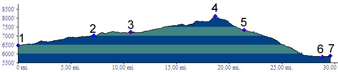
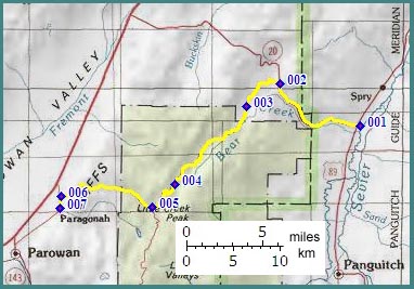
1.(6470ft,mile00) START-END EAST: junction Ut20 - US89; Bear Valley Junction
2.(7020ft,mile08) profile turns left onto FR77
3.(7210ft,mile11) stay left at this fork
4.(8122ft,mile19) TOP
5.(7330ft,mile22) dirt road from Mortenson Canyon joins from left
6.(5840ft,mile29) turn left to Paragonah
7.(5880ft,mile30) START-END WEST: Paragonah