| |
|
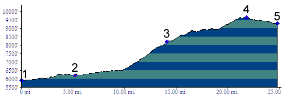
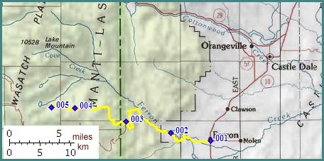
1.(5930ft,mile00) START-END EAST: START-END EAST: Ferron
2.(6210ft,mile06) START-END EAST ALTERNATE: Millsite Reservoir
3.(8210ft,mile14) turnoff to Ferron Canyon overlook, followed shortly by turnoff to Wrigley Springs Reservoir.
4.(9650ft,mile23) TOP at Willow Lake
5.(9280ft,mile25) START-END WEST: low point on road crossing Horse Creek