| |
|
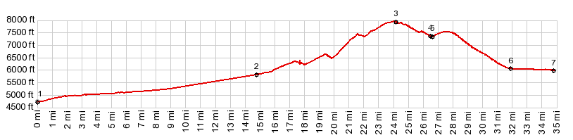
.(00.0m,4720ft)START-END WEST: low point on US89, at entrance to Logan Canyon
2.(14.6m,5810ft)profile turns up Temple Fork Rd to right
3.(24.0m,7970ft)TOP
4.(26.5m,7370ft)jct with heavily gravled Birks rd
5.(26.6m,7350ft)profile leaves heavily graveled road again, stays left
6.(31.8m,6070ft)Meadowville
7.(34.8m,5980ft)START-END EAST: jct Ut30 - Meadowville Dr, shore of Bear Lake
|