| |
|
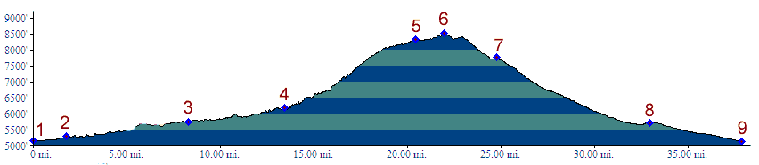
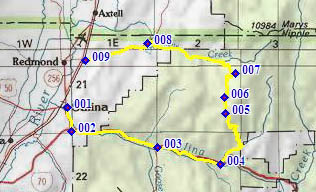
1.(5160ft,m00) START-END SOUTH: Salina: jct US50 -US89
2.(5310ft,m02) route turns 90 degrees left onto I70
3.(5760ft,m09) profile exits I70 at Gooseberry Rd exit
4.(6190ft,m14) profile turns left onto FR004 Water Hollow Rd
5.(8330ft,m21) jct with Great Western (ATV) trail on west side
6.(8520ft,m22) TOP: also jct with Great Western trail on east side
7.(7780ft,m25) route turns left down FR001
8.(5720ft,m33) route passes Willow Cree Reservoir
9.(5130ft,m39) START-END NORTH: jct FR001 - US89, north of Salina