| |
|
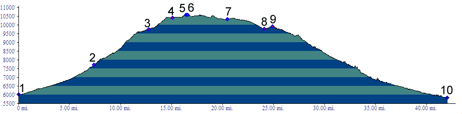
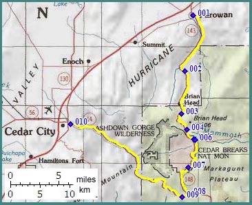
01.(5340ft,mile00) START-END NORTH: Parowan
02.(7700ft,mile08) Dry Lakes dirt road leaves on right
03.(9770ft,mile13) Brian Head ski area
04.(10418ft,mile16) Mammoth Summit and dirt turnoff to Brian Head Mountain on left
05.(10568ft,mile17) paved turnoff to Panguitch Lake on left
06.(10580ft,mile17) TOP
07.(10340ft,mile21) Point Supreme in Cedar Breaks National Monument
08.(9770ft,mile25) junction with Ut14. Profile continues right
09.(9900ft,mile26) Cedar Canyon summit
10.(5850ft,mile42) START-END SOUTH: Cedar City