| |
|
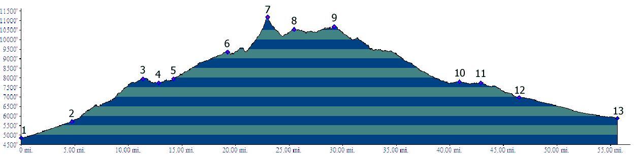
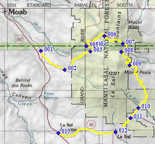
01.(4860ft,mile00) START-END NORTH: southern start of La Sal Loop Road, near Kens Lake
02.(5710ft,mile05) paved road on right goes up Pack Creek and to La Sal Pass, profile stays left
03.(8050ft,mile12) dirt road on right goes to Geyser Pass; profile stays left
04.(7750ft,mile13) dirt road on right goes to Oowah Lake; profile stays left
05.(7930ft,mile15) route turns right onto dirt road to Warner Lake
06.(9360ft,mile20) START-END NORTH ALTERNATE: start of TR33 single track up Burro Pass
07.(11170ft,mile24) TOP: Burro Pass
08.(10538ft,mile26) START-END SOUTH: Geyser Pass; profile continues south on FR129
09.(10700ft,mile30) highest point on FR129 Geyser Pass s(u)
10.(7800ft,mile41) dirt road on right goes to La Sal Pass; profile stays straight
11.(7730ft,mile43) jct with paved Ut46. Profile turns left to town of La Sal
12.(6970ft,mile46) town of La Sal
13.(5900ft,mile56) START-END SOUTH ALTERNATE: La Sal Junction