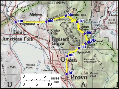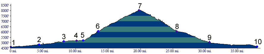
01.(4600ft,mile00) START-END SOUTH: Provo, Brigham
Young University area
02.(4840ft,mile05) entrance to Provo Canyon
03.(5120ft,mile08) Bridal Veil Falls area
04.(5200ft,mile11) Vivian Park
05.(5220ft,mile12) turnoff from Provo Canyon onto
Alpine Loop road
06.(6080ft,mile14) Sundance ski area
07.(8030ft,mile20) TOP: Alpine Loop road summit
08.(6070ft,mile26) Alpine Loop road joins American
Fork Canyon
09.(5070ft,mile31) START-END NORTH ALTERNATE:
junction Ut146, Ut92 at mouth of American Fork
Canyon
10.(4640ft,mile38) START-END NORTH: junction Ut92,
I15