| |
|
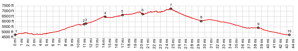
01.START-END EAST:jct US93 - Airport Rd,
just west of Panaca
02.turnoff to Bennett Pass on left
03.Bennett Springs Rd s(u), profile turns right
04.first shoulder summit at road, connecting with Dry
Lake Valley
05.second shoulder summit
06.another jct with rd connectiong to Dry Lake Valley
07.TOP, 7240ft, Manhattan Gap s(u)
08.profile turns right onto Nv320
09.jct NV320 - US93
10.START-END WEST:jct US93 - Airport RSd, same as
point 1
|