| |
|
|
|
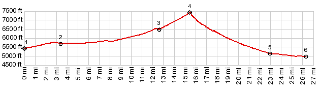
1.START-END SOUTH:jct I95 - unsgined
gravel road
2.profile stays right at this fork
3.jct with dirt road heading in a westerly direction
4.TOP,7420ft
5.jct Montezuma Well Rd - paved Silver Peak Rd
6.START-END NORTH:local low point on Silver Peak Rd,
before reaching the site Alkali
|