| |
|
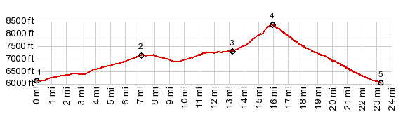
1.START-END WEST:site of Fletcher
2.profile turns left onto FR26 to Borealis Mine
3.jct with forest road connecting to points south and
west in valley
4.TOP,8380ft
5.START-END EAST:jct unmarked road up Powell Canyon -
Nv359
|