|
|
|
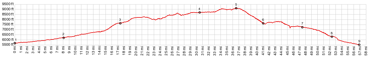
1.START-END WEST:jct NM4 - NM485, north of
Jemez Pueblo
2.Jemez Springs
3.jct with NM26 on left
4.entrance into Valle Calderas Reserource area
5.TOP:9100ft NM Valle Calderas s(u)
6.jct NM4 - NM501
7.Los Alomos
8.NM501 rejoins NM4, after its detour to Bandelier NM
9.START-END EAST:low point on NM4, where it crosses Rio
Grande, south of Otowi
|