| |
|
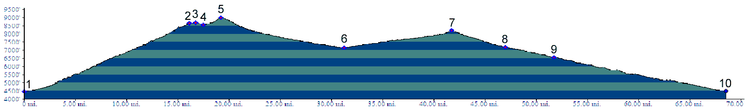
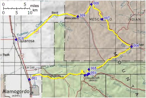
01.(4470ft,mile00) START-END SOUTH: jctUS70-US82, south of Alamogordo
02.(8650ft,mile16) NM244 to Sunspot takes off on right
03.(8680ft,mile17) US82 shoulder summit: Zenith Park area in Cloudcroft
04.(8570ft,mile18) profile turns left onto NM244
05.(8990ft,mile20) TOP: highest point on NM24, just short of turnoff to Silver/Saddle/Apache campgrounds
06.(7150ft,mile32) Elk Siver, UN244 turns left up Elk Canyon
07.(8200ft,mile42) intermediate summit
08.(7800ft,mile47) turn left down Tulorosa Canyon on US70
09.(6560ft,mile52) town of Mescalero
10.(4510ft,mile69) START-END NORTH: jct: US70-US54 in Tulorosa