|
|
|
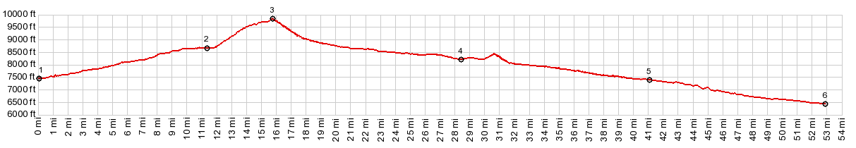
1.START-END WEST: low point at National
Forest Boundary on NM38, immediately east of Questa
2.Red River
3.TOP: 9800ft, Bobcat Pass
4.profile turns east onto US64 on west side of Eagles
Nest
5.START-END WEST: Ute Park
6.START-END WEST ALT: Cimarron
|