| |
|
|
|
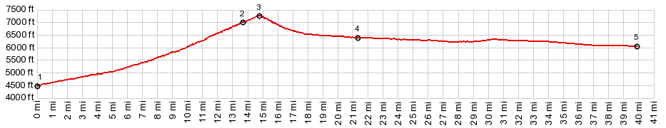
1.START-END SOUTH: Gibbonsville
2.Lost Trail Pass
3.TOP: Chief Joseph Pass, 7251ft
4.jct with eastern approach to Gibbons Pass
5.START-END EAST: low point on Mt43, just west of
Wisdom
|