| |
|
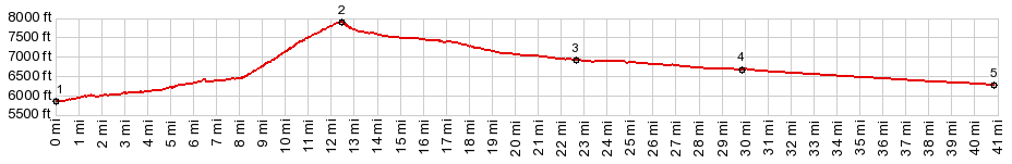
1.(00.0m,5840ft) START-END WEST: jct Main Street - Trail Creek Rd, Ketchum
2.(12.4m,7880ft)TOP: Trail Creek Summit
3.(22.5m,6970ft)jct with FR135 Wild Horse Creek Rd on right
4.(29.9m,6680ft)jct with Bartlett Rd on right
5.(41.0m,6280ft)START-END EAST: stream crossing, immediately before jct US93 - Trail Creek Rd
|