| |
|
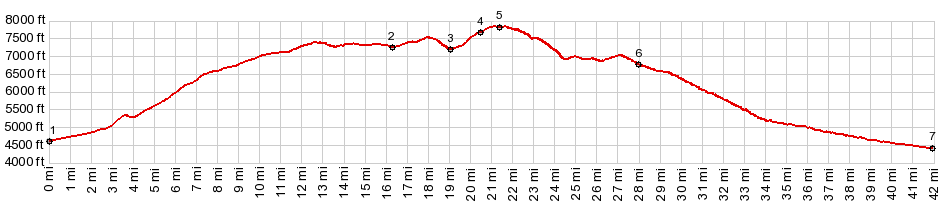
1.(00.0m,4600ft)START-END EAST: jct Main St - Bostetter Rd, just west of Oakley
2.(12.0m,7260ft)turnoff on right to various campgrounds
3.(19.1m,7170ft)jct with Trapper Creek Rd on left
4.(20.5m,7650ft)jct with Monument Peak Rd on left
5.(21.4m,7840ft)TOP
6.(28.0m,6760ft)Magic Mountain Ski Area
7.(41.9m,4400ft)START-END WEST: jct Rock Creek Rd - Fifth Fork Rock Creek
|