|
|
|
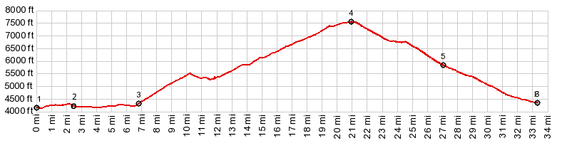
1.START-END EAST-1:Shoop Bridge at jct
US993 - Williams Creek Rd
2.profile turns left from Williams Creek Rd onto
Williams Lake Rd
3.profile turns stays right onto FR28 to a BLM
campground
4.TOP,7570ft: FR28 Williams Lake s(u)
5.profile joins Williams Lake Rd going downhill
6.START-END EAST-2: same as point 2
|