|
|
|
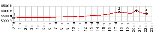
1.START-END EAST: road crosses Big Lost
River, south of Arco
2.profile turns onto loop road in the national monument
3.TOP: 6060ft, highest point on Loop Road
4.START-END WEST: lowest point on loop rd 5760ft,
shortly before road merges back into loop road
|