|
|
|
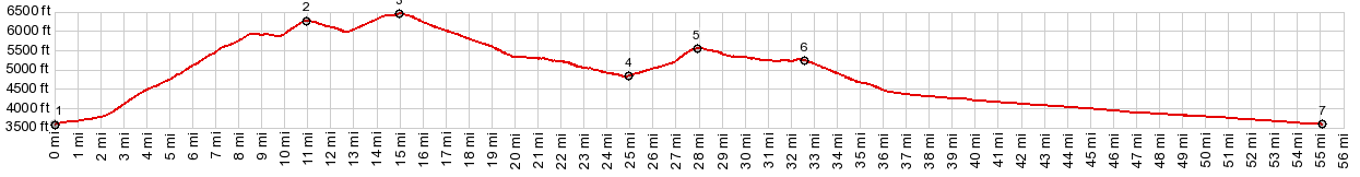
1.START-END NORTH EAST -1: jct US12 - Elk
Meadows Rd
2.road crosses from Montana into Idaho
3.TOP: 6480ft
4.low point at jct Brush Fork Rd - Elk Meadows Rd:
4750ft
5.FR373 Spruce Creek Rd(sh) :5560ft
6.profile turns left onto US12 at Lolo Pass
7.START-END NORTH EAST-2: same as point 1
|