| |
|
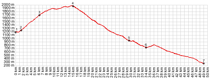
1.(00.0km,1190m) START-END WEST: Bacares
2.(01.4km,1240m)jct with A3102 north
3.(06.3km,1700m)Collado de Ramal
4.(15.1km,1970m)TOP: Venta Luisa: jct with road to Calar Alto on west side
5.(29.7km,0930m)START-END EAST ALT.: jct with road to Alto de Castro de Filabres on east side
6.(34.1km,0740m)START-END EAST: rondell, just east of Gergal
7.(49.1km,0270m)jct: service road to A3102 - N340A, south of Tabernas
|