| |
|
|
|
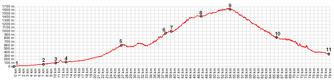
01.(00.0km,0002m) START - END SOUTH-1: Nice waterfront
02.(07.0km,0058m) Route from Col de Quatre Chemins connects on right
03.(10.2km,0089m) route goes left in Cantaron
04.(12.7km,0130m) there is an extra loop of 1km here, that is due to an error in the mapping program.
05.(26.5km,0565m) turnoff to Coroaze on right
06.(37.8km,0972m) Col Savel
07.(39.3km,0990m) Col Saint Roche
08.(46.7km,1428) Peira Cava
09.(53.9km,1607m) slightly after the TOP: Col Turini (TOP is about 1620m)
10.(65.8km,0786m) Moulinet
11.(78.8km,0348m) START-END SOUTH-2: Sospel
|