| |
|
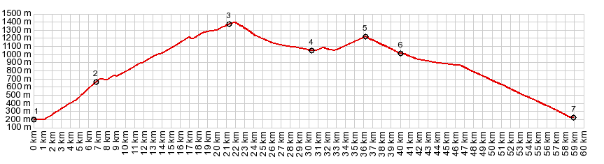
1.(00.0km,200m) START-END WEST: bridge across river l'Isere, west of Grenoble
2.(06.8km,660m)jct with road to Colombere and another approach from north
3.(21.3km,1400m)TOP:entrance to Tunnel du Morier
4.(30.3,1050m)Autrans
5.(36.1km,1218m)Col de la Croix Perrin Jaune
6.(40.0km,1010m)Lans en Vercors, route goes up Col Croix Perrin Jaune
7.(58.9km,220m)START-END EAST: road ends on D1532 in Sassenage, just west of Grenoble
|