| |
|
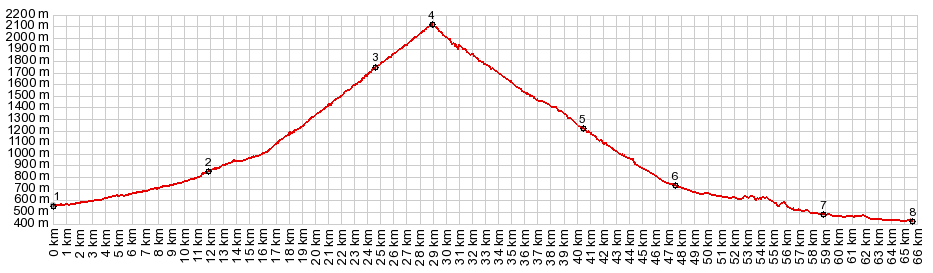
1.(00.0km,0560m)START-END EAST: Bsgneres de Bigorre
2.(12.1km,0870m)jct with D918 on east to Col d'Aspin in Saint Marie de Campan
3.(24.7km,1730m)La Mongie
4.(29.0km,2115m)TOP: Col du Tourmalet
5.(40.5km,1230m)Bareges
6.(47.6km,0730m)Luz St Saveur Le Coumet
7.(58.4km,0490m)START-END WEST ALT: turnoff to Soulom and Pierrefitte Nestalas
8.(65.5km,0420m)START-END WEST: bikepath turnoff below Argeles-Gazost
|