| |
|
|
|
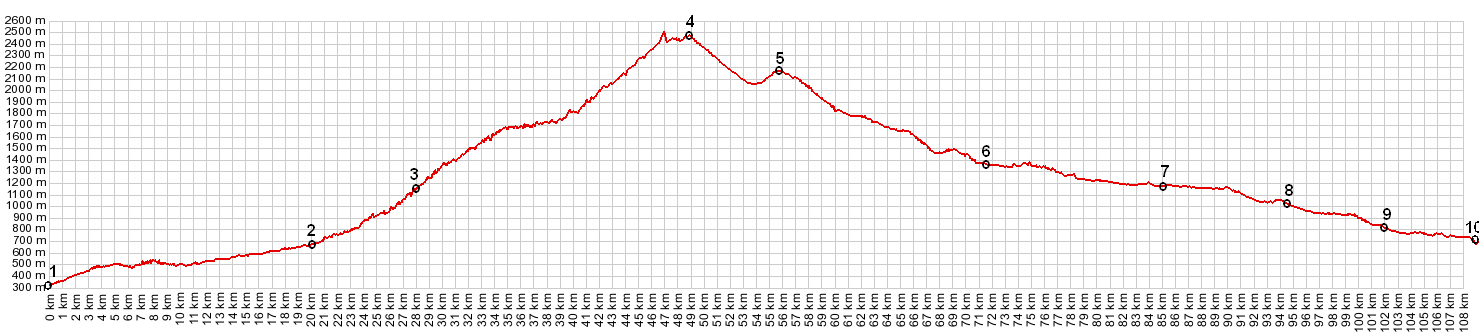
01.(00.0km,340m) START-END SOUTH: Meran, pedestrian
section in center
02.(20.0km,676m) START-END SOUTH ALTERNATE: Sankt
Leonard, jct with Via Passo Giovo
03.(28.0km,1203m) Moso im Pasaiertal
04.(48.7km,2509m) TOP: Timmelsjoch
05.(55.7km,2120m) Hochgurgl
06.(71.5km,1352m) Soelden
07.(85.0km,1175m) Laengenfeld
08.(94.5km,1020m) Umhausen
09.(102.0km,821m) Oetz
10.(109.0km,705m) Oetz - Bahnhof and jct with bike
path following Inn.
spike at km47 is due to a tunnel
|
|