| |
|
|
|
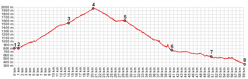
1.(00.0km,804m) START-END WEST ALT: Bourg Saint Maurice, near river l'Isere
2.(01.1km,812m) START-END WEST: Bourg Saint Maurice, turnoff to Cormet de Roselend
3.(13.9km,1545m) turnoff to les Chapieux and ville des Glaciers
4.(20.2km,1968m) TOP: Cormet de Roselend
5.(28.4km,1605m) Col de Meraillet on the shore of Lac de Roselend; also turnoff to Col de Pre
6.(40.4km,743m) START-END EAST: Beaufort
7.(50.6km,543m) Queige and turnoff to Col de la Forclaz
8.(59.0km,348m) START-END EAST ALT: Albertville, bridge over Arly
|
|