|
|
|
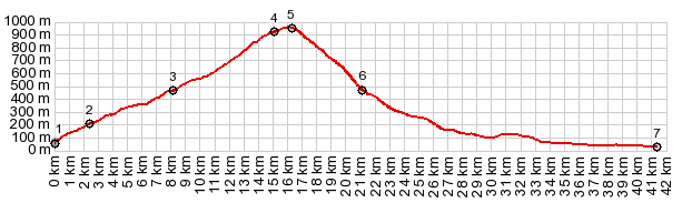
1.START-END EAST:jct 5053 - Istria coastal
road
2.profile turns left onto 5047 in Mihotici
3.Veprinac and jct with other approach to here
4.entrance to natural park.
5.TOP:jct with road to Vojok, 3150ft~960m
6.route crosses A8 express road
7.START-END WEST:low point on D500
|
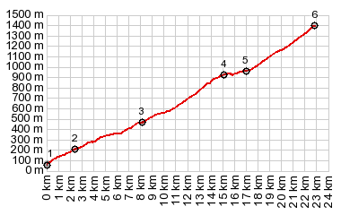
1.START-END EAST:jct 5053 - Istria coastal road
2.profile turns left onto 5047 in Mihotici
3.Veprinac and jct with other approach to here
4.entrance to natural park.
5.profile turns onto out and back to Vojok, 3150ft~960m
6.TOP: Vojok 1396m
|