| |
|
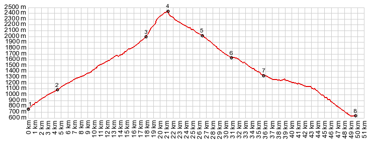
1.(00.0km,0769m)START-END NORTH: road to Port Aine leaves C-13, west of Rialp
2.(04.4km,1080m)going straight goes to Roni, main road switches back to east
3.(17.8km,1980m)Port Aine ski station
4.(21.2km,2439m)Pic de l"Orri
5.(26.3km,2010m)major dirt road intersection, where this profile turns hard left
6.(30.8km,1640m)profile turns right down valley on improved road
7.(35.7km,1330m)START-END SOUTH: profile meets Puerto de Canto road
8.(49.8km,0650m)START-END SOUTH ALT: jct with N260 in Adral
|