| |
|
|
|
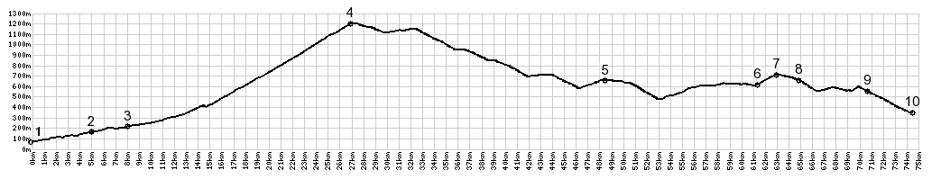
01.(70m,00.0km) START-END
SOUTH: SP74 takes off to the right in the north end of
Aulla
02.(160m,4.9km) Monti Di Luccianana
03.(210m,7.9km) Licciani Nardi
04.(1200m,26.9km) TOP: Passo Di Lagostrello
05.(660,48.1km) Palanzano
06.(610m,61.2km)jct with road to Pignone on right
07.(710m,63.0km)Lagrimone s(u)
08.(660m,64.9km) Antognola
09.(550m,70.7km) Boschetto
10.(350m,74.4km) START-END NORTH: Capoponte; bridge
over Torrente Parma
|
|