| |
|
|
|
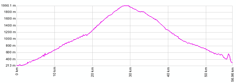
01.(km00,220m) START-END SOUTH: jct: Route du Vin bike
path, exit to Ora (Auer)
02.(km01,250m) Auer / Ora
03.(km14,1030m) take left off SS48 in Neuradeln
04.(km17+1/2,1210m) Redagno di Sotto
05.(km27,1989m) TOP: Jochgrimm / pso di Oclini
06.(km30,1830m) passo Lavaze
07.(km43,890m) route joins Karer Pass, profile
continues left
08.(km55,300m) START END NORTH: Carnedo
|
|
errors in elevation profile near km 55 are due to a tunnel