| |
|
|
|
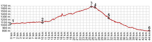
1.(00.0km,1080m) START-END EAST ALT: Bach
2.(10.0km,1120m) START-END EAST: Steeg
3.(18.8km,1410m) Warth
4.(25.5km,1690m) TOP: point of highest altitude
4.(26.7km,1660m) Hochtannbergpass
5.(31.1km,1280m) Schroecken
6.(44.3km,800m) START-END WEST: junction with
Faschinastrasse
|
|