| |
|
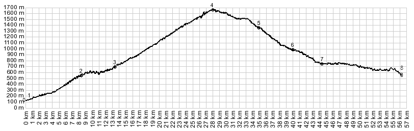
1.(148m,00.0km) START-END WEST: west of Ghivizzano, SP56
turns of SR445
2.(560m,8.7km) route from hilltown Coregia descends to
join with profile
3.(684m,12.8km) another road connects on the right with
mountain locations
4.(1664m,28.0km) TOP Foce a Giovo
5.(1365m,35.0km) dirt road terminates at gate onto paved
road
6.(1000m,39.9km) turnoff to Fiumalbo, immediately below
7.(900m,42.1km) START-END WEST: Pievpelago and turnoff to
Passo delle Radici on left
8.(580m,56.2km) START-END WEST ALT: aproximate
intermediate low point near Strettara