| |
|
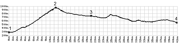
1.(300m,00.0km) START-END SOUTH: bridge over L'Isere,
south of Saint Pierre D'Abigny
2.(950m,10.9km)TOP: Col du Frene
3.(730m,19.4km)START-END NORTH: jct with D60B to Jarsy on
right
4.(540m,40.2km)START-END NORTH ALT: Cusy